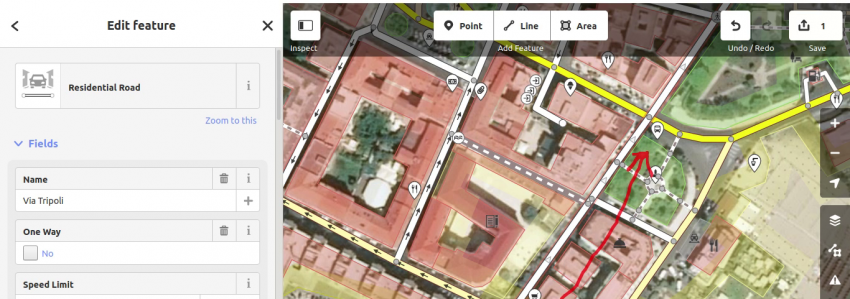
Dopo aver chiarito gli aspetti fondamentali di OSM passiamo ad effettuare i primi lavori di mappatura. Per ora ci limiteremo a delle semplici modifiche che tuttavia si riveleranno molto utili a chi utilizza la mappa. Esplorando la mappa della nostra città come descritto nel precedente articolo abbiamo notato che in alcune strade non sono stati…
Tag: NerdCorner

OpenStreetMap: Introduzione
Con questo inizia una serie di articoli su OpenStreetMap: dopo aver acquisito le conoscenze sulle sue caratteristiche principali impareremo come modificare o caricare nuovi dati, ovvero mappare. Di cosa si tratta Ormai diffusissime soprattutto negli ambienti legati alle attività sportive outdoor perché mostrano strade sterrate, sentieri, fonti ed altre caratteristiche non visualizzate dalle altre mappe…

The computation of the elevation gain
Cyclists, hikers and trail ranners know that the total elevation gain or simply elevation gain is the sum of any positive elevation change that occurs during an excursion. This is a very important parameter in the evaluation of an excursion and very difficult to evaluate correctly for the reasons that we will show you in…

Some numbers on our trails
In a recent post we talked about the classification of technical difficulty of mountain bike trails by describing two different scales, here is the article. No trail is homogeneous from the beginning to the end with respect to its overall difficulty level: typically a trail classified as S3 of the Singletrail Skala, in short STS…


 Italian